
Coverage & Range Tests
At a glance
| Item | Detail |
|---|---|
| Tools | Meshtastic Site Planner, rangetest CSV, python-rtmap |
| Reference node | Solar WisBlock ~7 m over farm shop |
| Lesson | Height and peer antenna height matter; Waco fill-in stays limited from this site alone |
Site planning

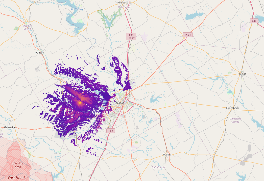
I used the built-in Site Planner to estimate coverage for the solar-powered WisBlock at roughly 7 m / 20 ft over the shop at the farm.
Pocket / HT-height receivers
This image shows receive coverage and strength if the peer node is at handy-talky or pocket-node height (on a person or in a vehicle).
Terrain shadows start to show — hills cut pockets of coverage.
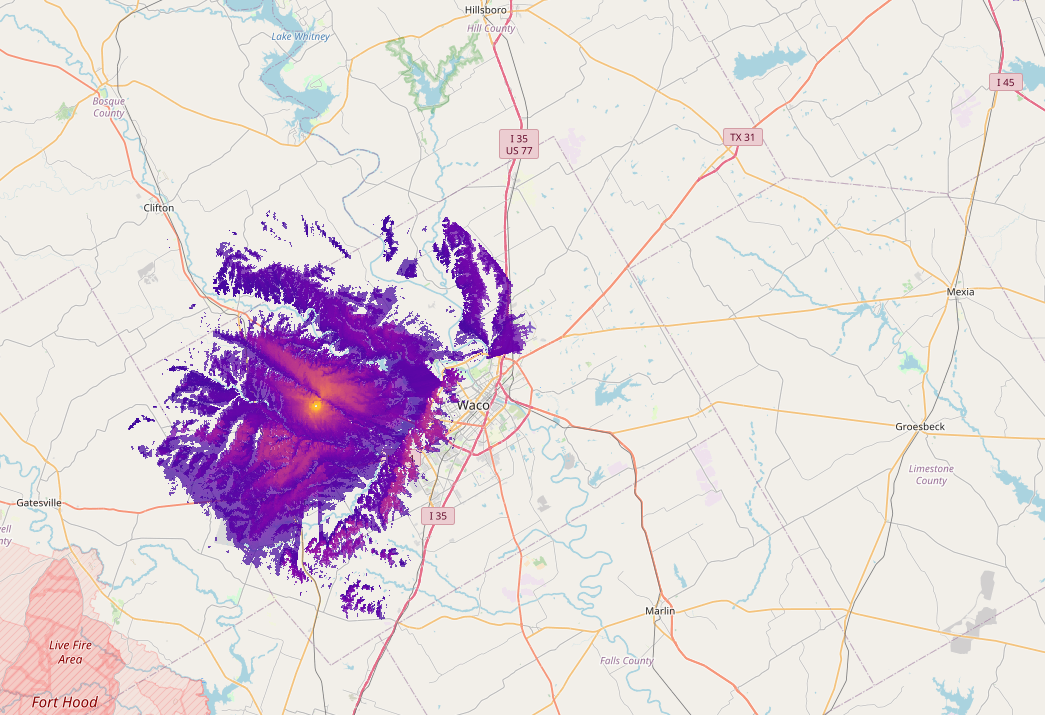
Mid-height outdoor peers (~7 m)
Peer nodes mounted outside at roughly the same class of height fill some gaps but do not dramatically expand the footprint.
Coverage fills in; the overall bubble does not jump as much as people hope.
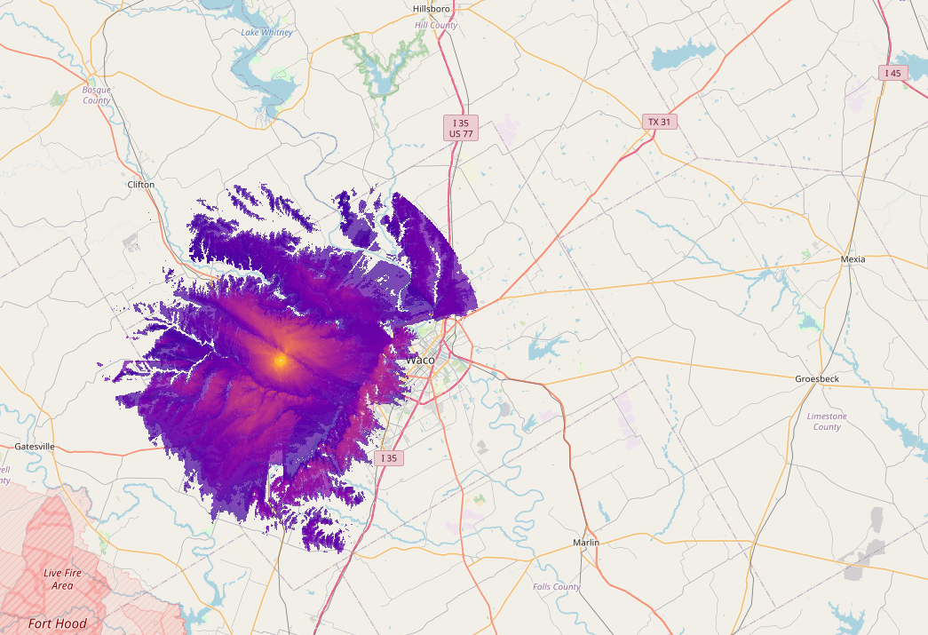
High router peers (~15 m / 45 ft)
Peers at router height (~15 m) show stronger signals and a more complete area — still limited coverage of Waco from this farm site alone.
How I run range tests
- Fixed node → role ROUTER or ROUTER_CLIENT on the roof (e.g. 60 s broadcast interval while testing)
- Mobile node in the truck (LilyGo T-Echo or T-Beam)
- Pull
rangetest.csvfrom both nodes after the drive - Render with python-rtmap (The Comms Channel tooling; containerized here)
Container image (Linux or Windows WSL):
docker run -it --rm -v "$(pwd)":/data quay.io/brthomps/python-rtmap-amd64 /data/rangetest.csvExample map output:
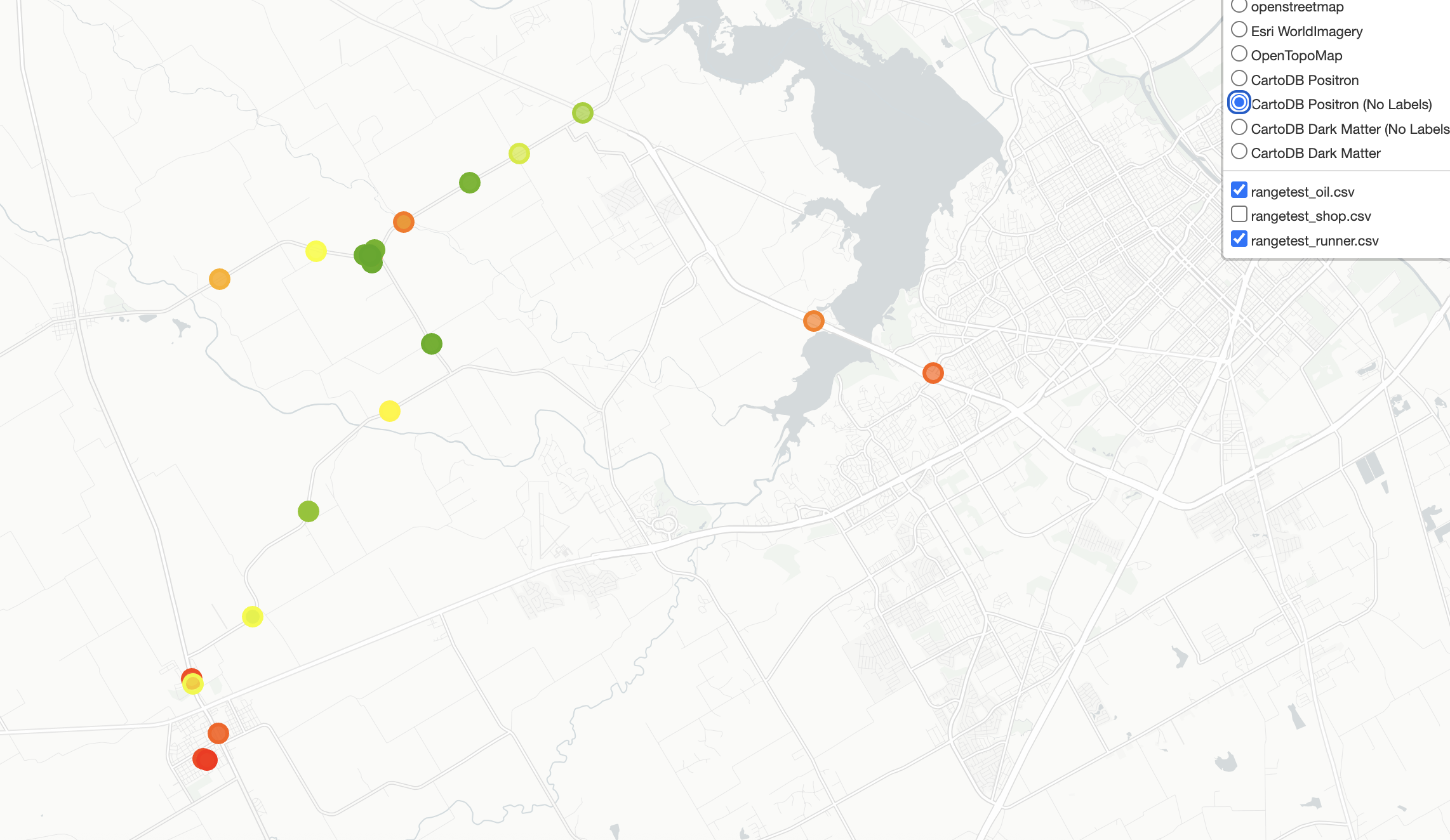
Feel free to reuse the image and add your own tests.